Last month I expressed mild disappointment over not achieving any long technical days in the mountains this summer. That is, little in the way of exposed ridgeline traverses, multipeak link ups or self-supported ultras in the backcountry. I mainly stuck to single summits, many I know well, going faster and lighter than ever before. In general though, one can either choose to be mediocre at new things (the definition of “novice”) or become really good at a given activity by doing it over and over again. It’s obvious now that the fruit of this summer wasn’t an extension of my activities into new domains, more a sharpening or deepening of what was already there.
This summer still had its unicorns and Mount Aylmer was one of them. Sean and I ascended this 3162 metre peak in June before I left for France and before Parks Canada seasonally implements restrictions on the trail to minimize encounters with grizzlies. Once the hiking restrictions ended in September I gazed out my window at Aylmer, then down at a window of good weather forecasted on my smartphone and knew my summer had built towards this objective: tagging Aylmer from town.
There is something to be said for “town” in the context of mountain running — mostly I’ve said it here — but in essence, it provides contrast. “Town”, the seat of comfort and habitation, is Alpha to the summit’s frigid, blustery and uninhabitable Omega. At the same time, the barren summit represents challenge, growth and the exaltation of our greatest selves while the couch, cafe or office chair implies to mountaineers a stagnance that reeks stronger than death.
This year I came to appreciate diverse forms of locomotion in the mountains, particularly how a bike can be integrated with bagging peaks. Seeing only few weeks of non-winter left in the alpine, I felt like I had a choice: I could hop in the car and drive somewhere and do a gnarly ridge traverse or maybe link a couple peaks, or I could travel under my own power to a mountain I reverently stared at from my window every day, and do it faster, stronger and in a 100% human powered fashion. There’s nothing novel about bagging peaks on a bike, as Anton spent the summer rehabbing his shin by biking all over Colorado and Justin Simoni climbed the state’s 54 fourteeners in a row, pedaling in-between them. If mountain running is supposed to be about distilling mountaineering to its most minimal form, there ultimately seems something superfluous about driving a vehicle to the trailhead to do it.
My day doing an Aylmer duathlon started at seven AM with a calzone and espresso. I left the house at 7:43AM, saddling up on my aluminum framed Argon 18 roadie and riding out of town.
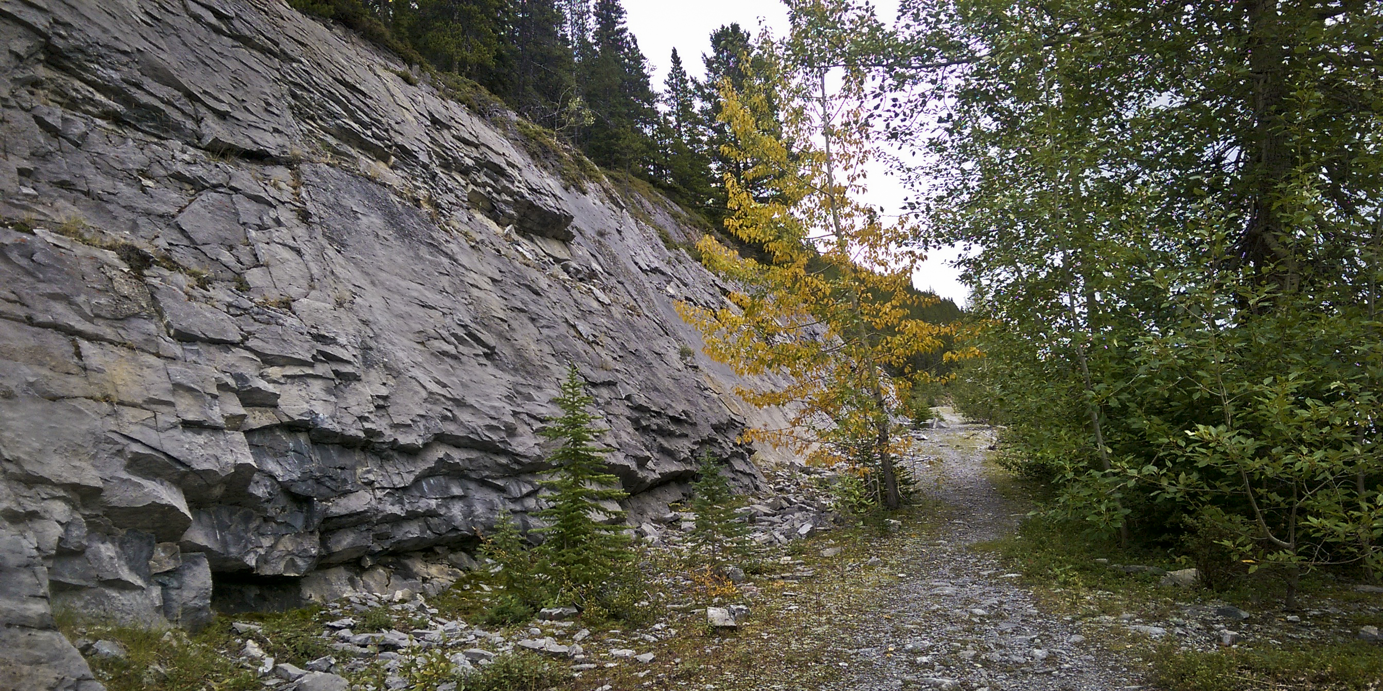
The ride out to Lake Minnewanka took half an hour and passed by easily and quick. I locked up my bike near the Minnewanka boat docks and started trotting. After departing the lakeshore trail and heading towards Aylmer Pass, I bellowed with greater volume and frequency than usual to warn off any grazing bears.
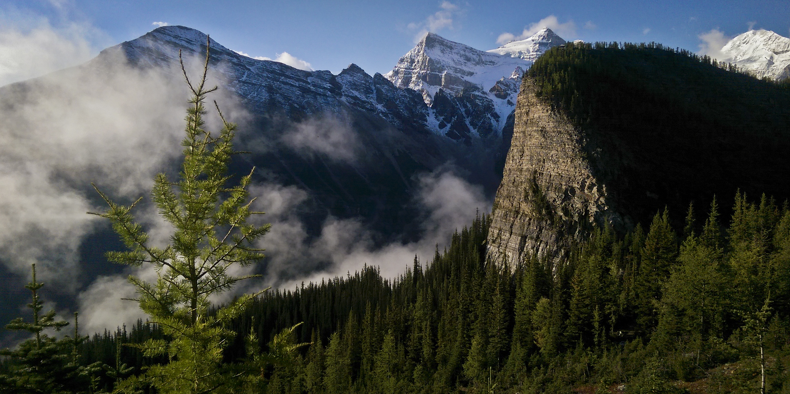
The traverse on talus below the ridge was fun as I hopped from rock to rock whilst admiring the flawless weather and listening to Sweet Valley at full blast. When Sean and I bagged this peak in June, the summit was enveloped in a dark cloud as we topped out above the avalanche gully. Today it was a hard, blue sky from one horizon to the next.
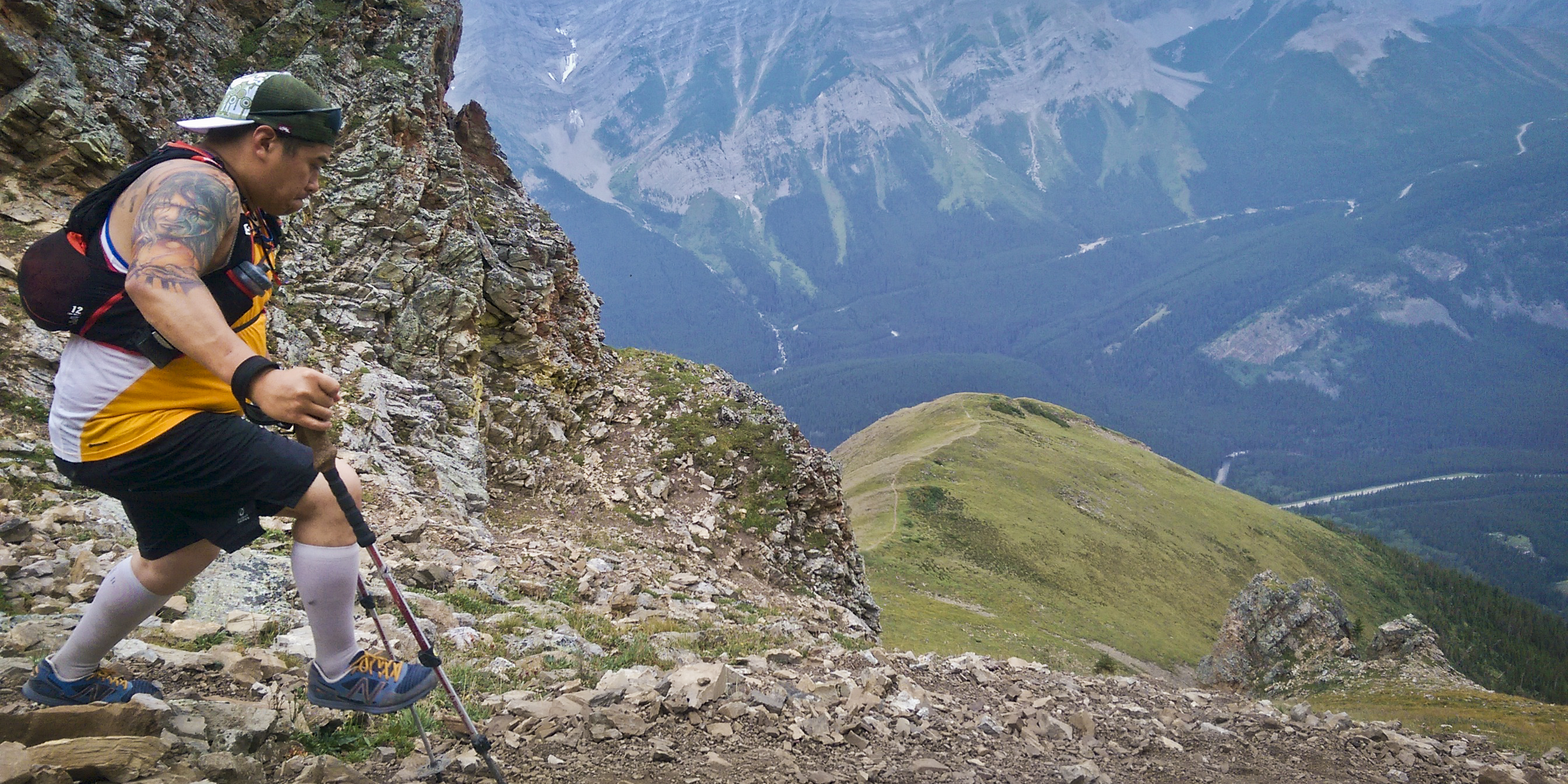
The homestretch to the summit is steep but untechnical and I slogged at a pace that was actually too hard for the altitude I was at. I repeatedly had to stop and catch my breath, reminding myself to hike slower or frustratingly redline myself every couple minutes.
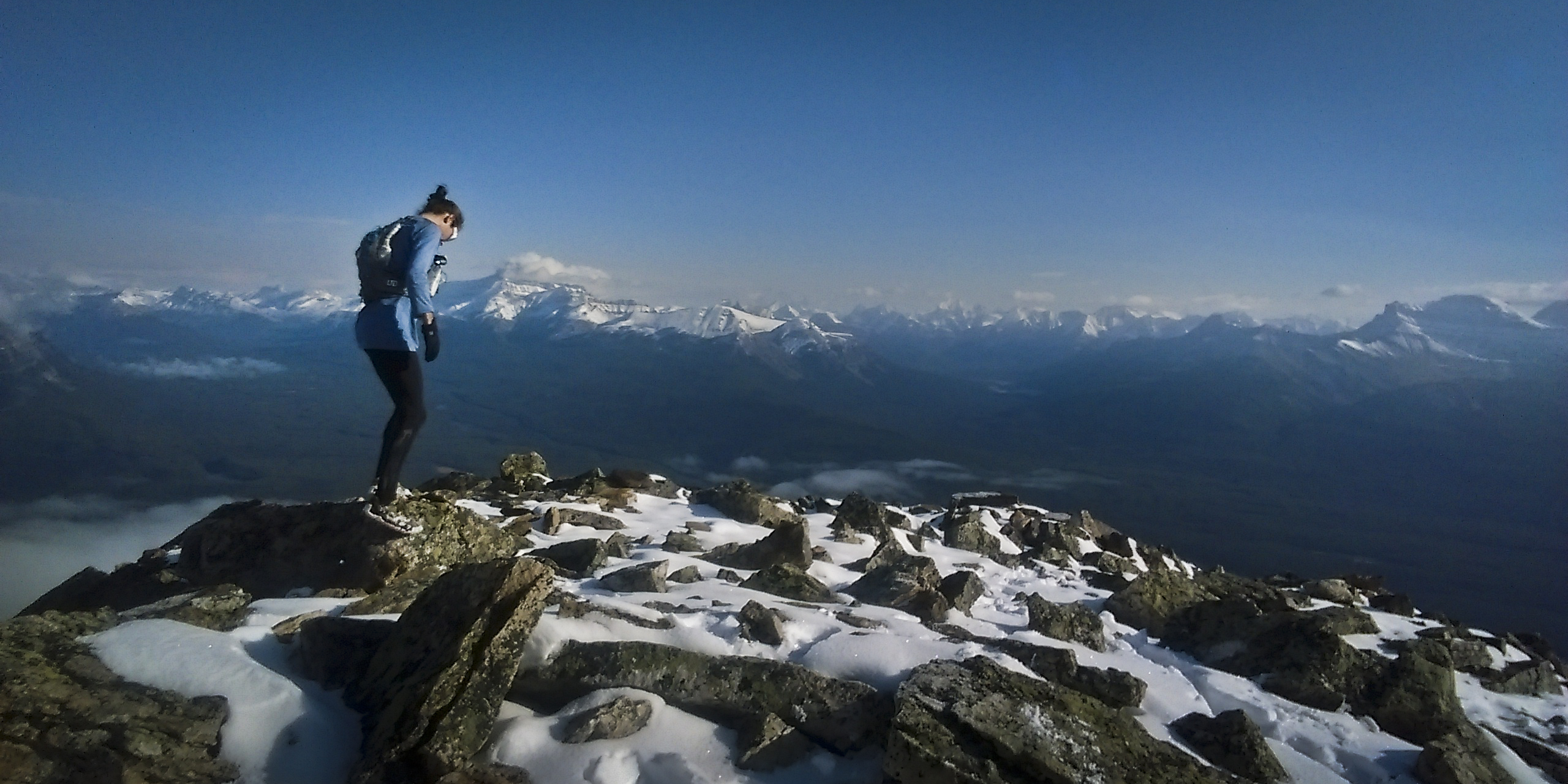
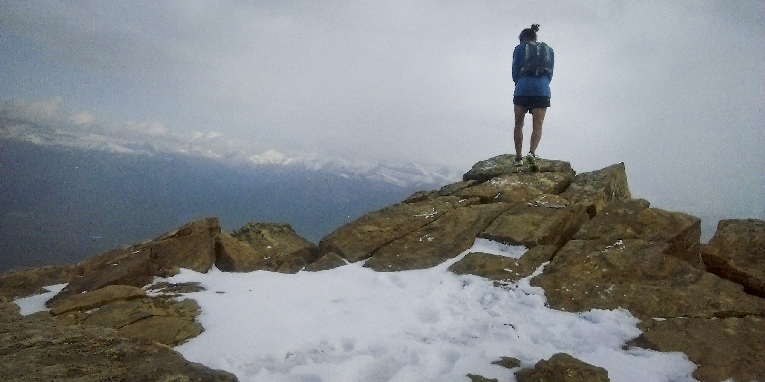
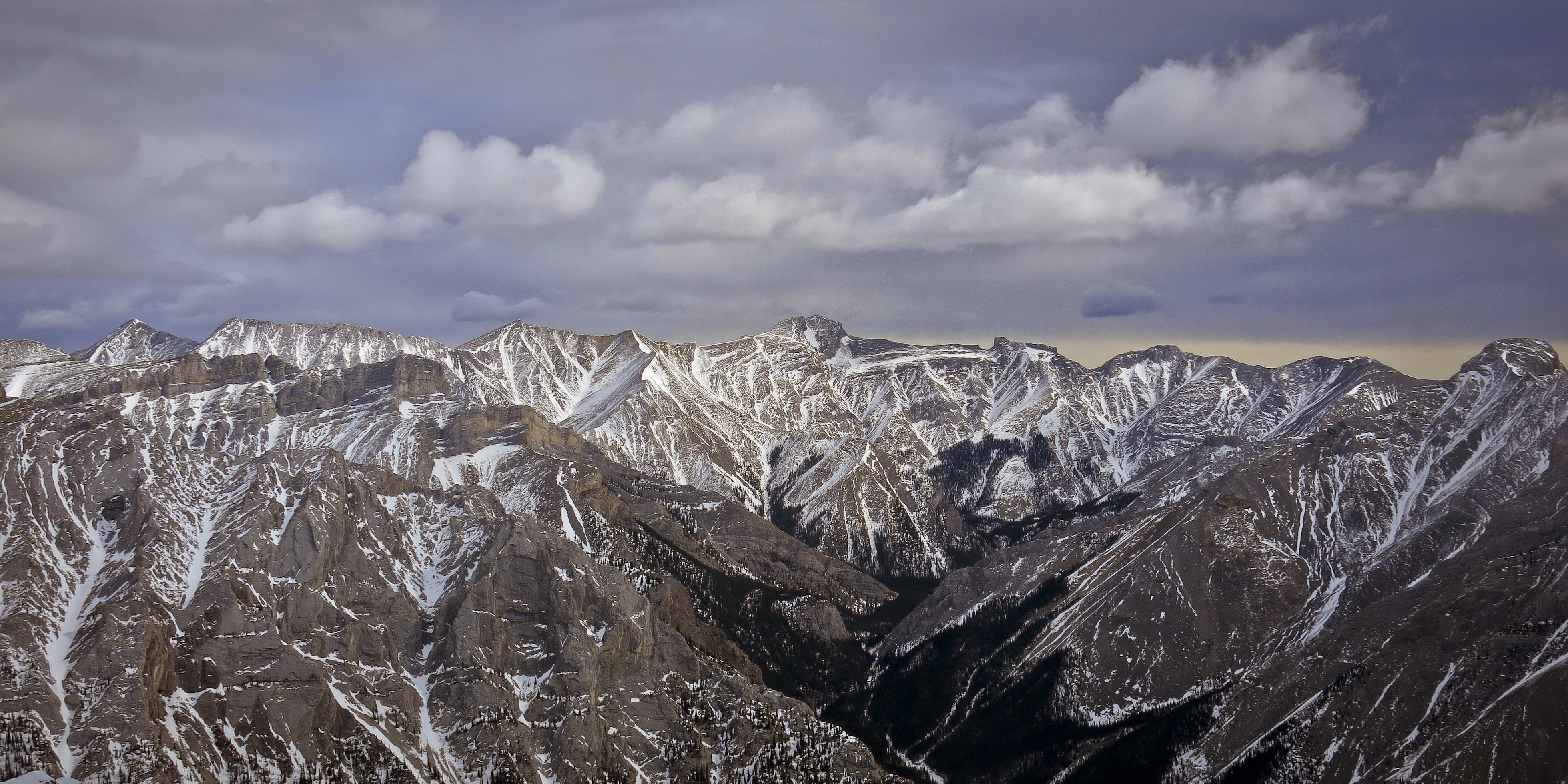
I tagged the top in 3h57m, adjusted the poor wooden stick stuffed in the summit cairn and took in the scenery. “The view is pleasing but not breathtaking,” says Kane in the guidebook, but it’s pretty decent. Prairies to the east appeared like the placid surface of a lake while views westward grew into a swelling sea marked by 11,000 foot whitecaps — Assiniboine, Temple, then the Goodsirs, looking like Dracula’s castle in mountain form.
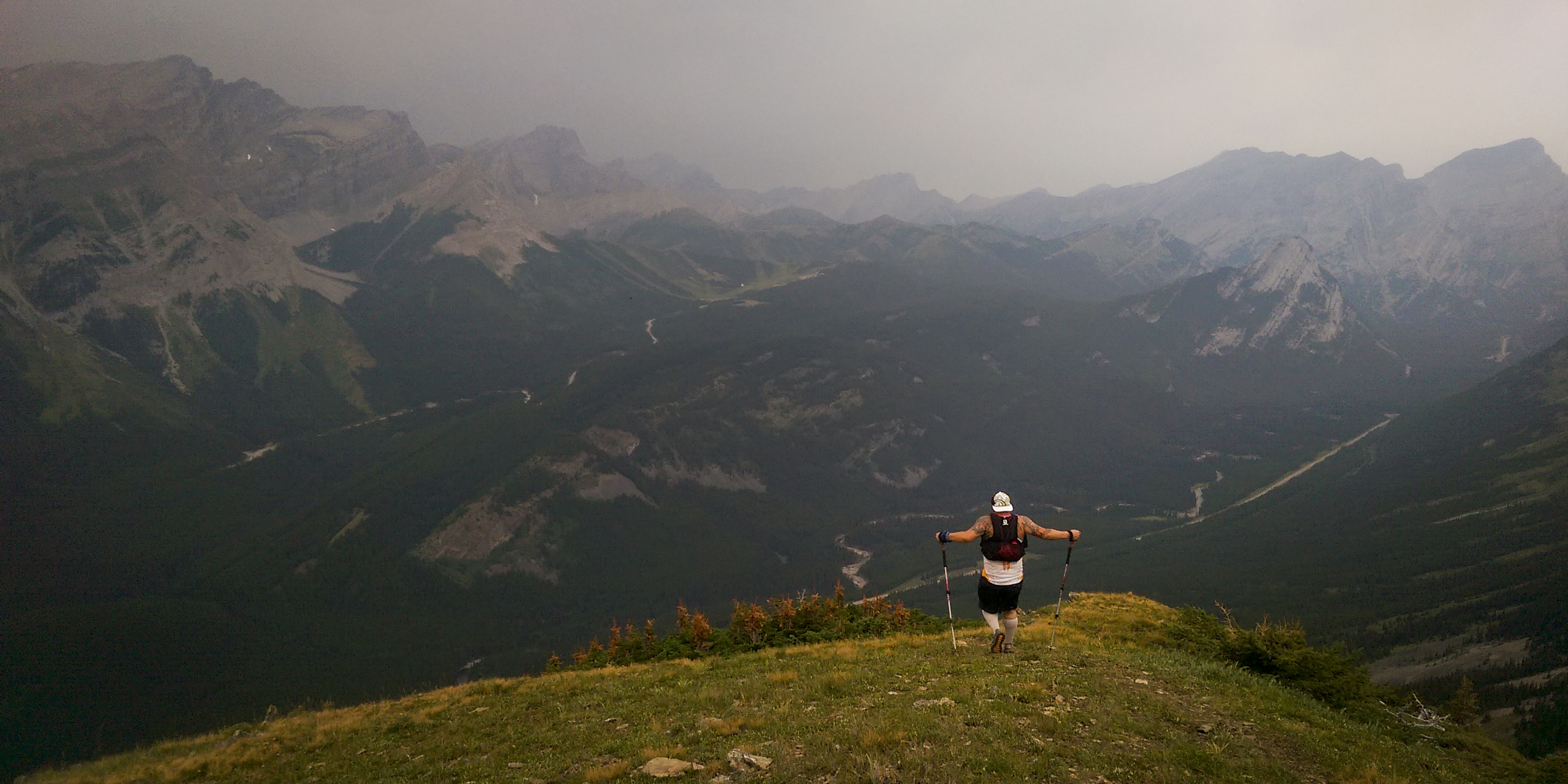
I hung around on top for nineteen minutes then headed down, plummeting 1600 metres in a fraction of the time it took to get up there. The only complication I encountered was descending too far down the avi gulch, past the faint Aylmer Pass trail which intersects it. When the eerie feeling of, “Something doesn’t feel right,” struck, I turned myself around and marched back up the drainage for a couple minutes until I located the path.
The jog back to my bike was mundane but the lake was pretty and provided a cool breeze which made things quite comfortable. I remember our run in June being sweltering on the way out and on that occasion added injury to insult by bashing the soft underside of my foot on a rock. I reached my bike in 6h20m and flew mostly downhill back to Banff Avenue and Caribou Street in 6h49m, only nine minutes longer than our trailhead-to-trailhead time when we drove there in the spring.
Now when I look out my window, Aylmer is like a friend; a neighbour that I nod to, and it nods back. My experience with this mountain was more than a fling, more than just ticking the peak in the back of the scramble book and that’s it. I had a crush on Mount Aylmer and this is how I expressed it, and I’d like to think Aylmer recognizes and respects my effort in some metaphysical way.
Next summer, I just gotta swim across that lake and make it a triathalon.
Splits:
0h30m Lake Minnewanka boat docks
1h31m Aylmer Pass/Lakeshore jct
3h57m Mount Aylmer Summit
5h31m Aylmer Pass/Lakeshore jct
6h20m Lake Minnewanka boat docks
6h49m Banff (Banff Ave./Caribou St.)
50km total (20km bike/30km run) | 2127m vertical [GPS data]
August flew right by with a flurry of disparate summits, though I feel like I underutilized this prime part of the season, for sure. The positive perspective to my summer is that I have remained healthy, increasingly fast in the domain of running up and down mountains, and have learned a lot about my overall system and how to sustain and/or tweak it. I have become lighter, more minimal — practically naked at times — which translates directly into speed and a deeper relationship with mountains I already know. I’ve also spent more time above 3000m than ever before, which is important to me, to visit that zone where the rest of the world is muted and life consists solely of the elements, all amplified to a violent pitch.
Yet I can’t shake the feeling that complacency kept me from pulling off any “big projects” this summer, or really any big days, barely running anything over 30kms since the Mont Blanc 80K in June. Distance isn’t really what matters to me, it’s the feeling of adventure, mainly gained from long distance in the backcountry, and I didn’t do any long backcountry trips (like last summer) either.
The weather in September has changed abruptly to autumn, snow has fallen and I doubt the stuff at higher elevations is going away. My mindset has shifted to two upcoming events this month, then making the most of fickle fall conditions until my parents come to visit in October. September 11-13, 2015 is our second Mountain Stride Fitness retreat in Kananaskis, designed to transport your trail running to an alpine landscape of peaks, ridges and valleys. We still have a few spots available! See mountainstridefitness.com for more info.
September 18-20 are three days of Golden Ultra in Golden, BC. I won’t be racing but other members of the Mountain Stride crew will be. I’m excited to see what the race organizers have devised for their Blood (VK), Sweat (55km) and Tears (20km) races. I ran the vertical kilometre in Golden last year and feel the area has great potential as a trail running destination. I’ll be heading to Golden to take pictures and see my crew.
Wedged into the middle of the Golden Ultra weekend is the 5Peaks Glacier Grind in nearby Revelstoke, BC that will be my second and final trail race of 2015. I originally signed up when this race was supposed to take place in Rogers Pass and had some 4000+ metres of climbing to its name. Swarms of hungry grizzlies caused the race to be moved to Revy, where it will begin in town, race to the top of Mount Revelstoke and descend to Jade Lakes, turn around and head back up over the summit and plummet down to town. The new race is slated to be 44km with 2600m of climbing, a real SkyRace format that should be a fast and exciting alpine race for sure.
Other randomness:
Check out this sweet profile of the Banff Three Peak Challenge, written by my friend Tera Swanson and published by local Banff mediahouse Crowfoot Media. The piece details the history of attempts on the 70km/5000m route which ascends three peaks around Banff townsite. The article also includes bits of interview with my Mountain Stride buddy Sean Bradley, who now holds the FKT, and a few pictures taken by me during his attempt last July.
Without further ado, let’s get to some of the trips I took in August:
01/08/15 – Edith North (2554m) – 15km/2h57m/1314m
A blistering run up the north peak of Edith that was basically nude, save for a pair of split shorts, running shoes and 500mL of water. Apparently I didn’t take my phone because I have no pictures and almost forgot about this trip until I looked at my Movescount page. Another example of going faster, lighter and naked-er on mountains I know well this summer. The temperature was bound to rise over 30 degrees celsius that day so I had to ration my water, taking small sips and sloshing them around in my mouth to alleviate the symptoms of dehydration to trick my brain. All of the gullies en route to Cory Pass ordinarily offering water in the springtime were bone dry. I hit Cory Pass the first time in 1h27m, tagged the summit of Edith in 1h57m and descended back to the parking area in 2h57m, blasting past a lady who’d chastised me for carrying nothing — she’d had a good point. GPS data.
08/08/15 – Sparrowhawk (3121m) – 10km/1469m/3h24m
Ran up and down Mt. Sparrowhawk. The intention was solely to summit but like most of my single summits this summer, I tackled it with a decent amount of intensity. Made time through the incessant loose cobbles which were good training for Sunwapta later in the month. Tagged the summit in about 1h50m. The top revealed a 360-degree panorama of sweet mountains including Assiniboine, peaks of Lake Louise, and Kananaskis front-range fare. GPS data.
09/08/15 – Rundle (2949m) – 18km/1560m/2h32m
Ran up Rundle, fast. Set out to establish a fast time, aiming to break 3h05m, really the only documented fast time I’ve come across. My watch died partway up so people will have to take me for my word, otherwise I recognize the poor documentation involved in this attempt. Not much to say; the weather was decent and the route not very busy. Jogged from home, reached the summit in 1h36m from the trailhead and returned back to the trailhead by 2h32m. Passed one regular scrambling party and a huge group of Japanese hikers who I saw at the hot springs the following day. I remember thinking at one point that I couldn’t possibly descend fast enough to break 3h05m but the descent went much quicker than expected. Will have to go back with my watch fully charged one day. Incomplete GPS data.
14/08/15 – Opal Ridge South (2560m) – 7km/1018m/~3hrs?
Opal Ridge with Glenn. Drove to Kananaskis in the morning and deliberated about what to do. At last we settled on Opal South. The hike up was pleasant, climbing the edge of a wide drainage and circumventing large pinnacles. Got chased off the summit by a big thunderstorm heading east. We swiftly descended through loose shale to safety but felt bad for non-running parties still up on the mountain. “If they weren’t mountain runners before, they are now!” we joked as huge cracks of thunder erupted around us. Escaping thunderstorms is turning into a side hobby for Glenn and I.
20/08/15 – Sunwapta FKT (3315m) – 12km/1745m/1h59m to summit/3h32m RT
Sunwapta, fast. This is one of the things I definitely wanted to get around to this summer, albeit hardly a “big project” by any means. This is the last of three FKTs set by Steve Tober some time ago — the others being Bourgeau and Fairview — which I’d been gradually scooping up. None of these are difficult mountains, however they are justifiably popular, untechnical peaks with great views. Sunwapta has the distinction of being a nearly eleven thousand foot scree slog poised literally across the street from glaciated giants of the Columbia Icefield. Steve’s speedy ascent is also mentioned offhandedly in Alan Kane’s Scrambles in the Canadian Rockies, a mountaineering bible near and dear to the hearts of many peak-baggers including myself. I knew I had to go after this objective.
“Routefinding” on this mountain is virtually nonexistent, though it took me a few tries to locate the very start of the trail — reading the instructions properly helps. After figuring it out, I trotted back to the parking lot and started my watch for the speed attempt. I scampered up the loose rubble on all fours and jogged along the summit ridge, sucking back huge lungfuls of air. Tagged the summit at 1h59m, twenty minutes faster than Steve Tober’s 2h20m ascent in 1998. I hung around on top for five or ten minutes to absorb some the epicness that surrounds Sunwapta: on one side are endless ranges of parallel dipslope peaks; on the other are huge eleveners plastered and smeared with ice and snow. The Canadian Rockies’ second highest peak, 3747m Mount Columbia hovers above the whole panorama. GPS data.
22/08/15 – Cory-Edith Loop – 14km/1200m/2h56m The Cory-Edith Pass loop, combined with a scramble up Mount Edith, has become one of my fallback, go-to mountain runs this summer, and for good reason: it’s close to home; I can ride there on my bike, skateboard, or run if I have to. It possesses a great amount of killer singletrack largely above treeline, big craggy cliffs, and allows you to complete an aesthetic loop around Edith. Even without bagging a summit, the trail around Edith delivers both fast, flowy running and techy rubble wrangling on the backside of the mountain. Combined with the scramble and you get a narrow, claustrophobia-inducing chimney/ramp, some third-class slab scrambling with exposed run-out below, before gaining a generally exposed-feeling summit.
This day I didn’t do the Edith scramble due to the first snowfall of autumn having just transpired. I’ve turned around looking at those snowy slabs on Edith before. Today I started slogging up the snowy col towards them but wasn’t in the mood to wade through icing sugar to simply inspect the terrain. So it was simply a loop, which I still wasn’t confident about completing, given the snow on the backside. Luckily a pack of bighorn sheep had broken trail for me in the night so I followed their hoof-prints to the base of Mount Louis and around the rest of Edith to finish the loop. GPS data.
27/08/15 – Eagle Mountain AKA Goat’s Eye (2823m) – 14.5km/1187m/3h01m
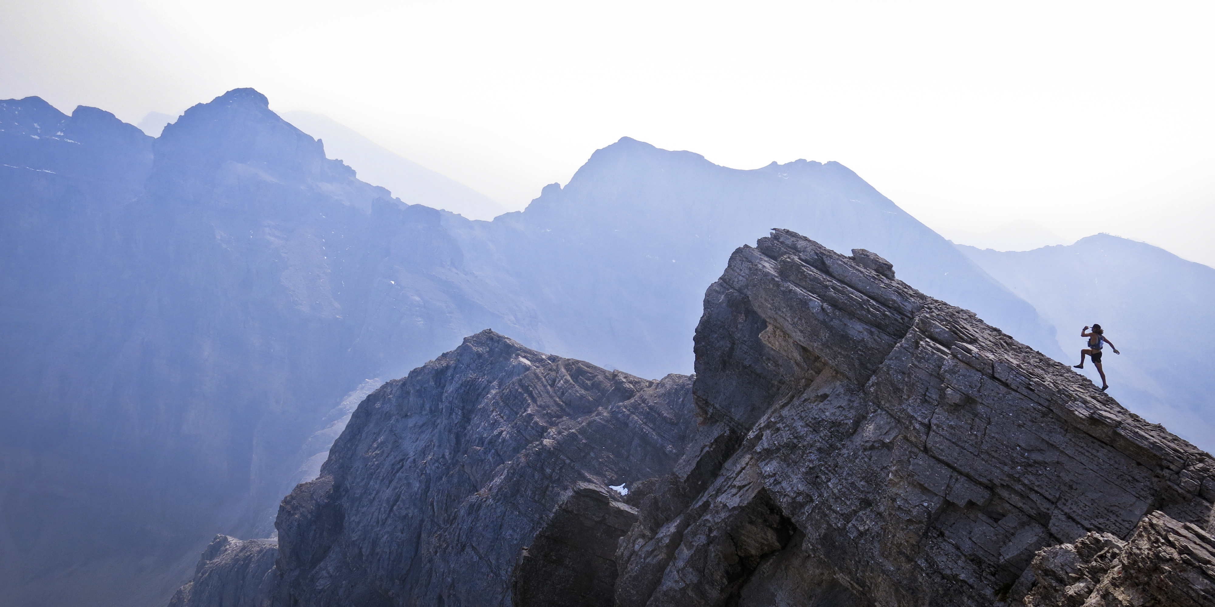
Smoke from wildfires in Washington completely filled the skies of the Canadian Rockies for a few days, making all of our mountains disappear. Visibility improved a notch from absolutely zero so I headed out for a run. I jogged up the ski-out at Sunshine Village and nearly turned back twice before reaching the Goat’s Eye lift; the smoke was so bad, it felt like I was only employing 10% of my lung capacity. However, views and air quality improved ever-so-slightly the higher I ascended (or so I told myself), plus I am very stubborn so I forged on. Made the top of Goat’s Eye in about 1h40m, took a few pics (including the Kilian-esque image at the top of this post) then descended back to the parking area in 3h01m. Pushed the velocity downhill on the ski-out, reaching a 2:20 pace and a max speed of 26.6 km/h. Hee hee. GPS data.
29/08/15 – Bell Attempt (2734m) – 8.5km/1226m/2h18m Attempted to bag a unicorn but a thunderstorm masked by lingering smoke chased me off the summit ridge. I approached from the Boom Lake side in overall fast time. Once I reached the ridge (too far to the right/east, as many others have done), the wind became gale-force. I messed around on the ridge, probing the route up Bell and bagging a different highpoint but knew I wasn’t going to get up Bell today. The weatherman, combined with my inner mountaineer, called for intense storms and the dense smoke meant I couldn’t see one coming, even if it was one range over. After descending back to Boom Lake, the first raindrops started to fall but spared me until I reached my car in the parking lot. GPS data.
03/09/15 – AM – St.Piran-Fairview Double – 22km/1921m/3h34m A little double-bag testpiece I’ve done a few times now. Not profoundly epic but two easy mountains — about a vertical kilometre each — in very pretty surroundings in a famous location. As usual I had ideas to do something else but fresh snowfall and weird weather dictated I do something relatively safe. Lake Louise is a place one does not venture in the peak of summer for fear of way too many cars and selfie-stick waving tourists packed into one location. Since the turn of the month, they have all evaporated, leaving this majestic mountain playground for locals to play with.
I disposed of St. Piran swiftly. Though I packed Microspikes, the snow wasn’t an issue and I never put them on. The peaks of Skoki et al (where I’d wanted to go today) looked amazing, painted with a band of white from 2000m up. Though St. Piran is probably one of the easiest mountains in the Rockies — I’m inclined to call it a hill — the views from its summit are perhaps some of my favourite.
I raced back to the Lake and stopped briefly at my car to change from winter into summer attire; I was soaked with sweat. After a ~3min transition, I started jogging up the Fairview trail. I tagged the summit amid an immense snowstorm rolling over the Divide and blotting out the skies around me. This isn’t the first time this has happened to me on Fairview. I threw on a Gore-tex shell and my Microspikes and quickly descended, reaching the Lake at 3h34m, most likely my PR for this route. GPS data.
Splits:
1h05m St. Piran summit
1h43m Lake Louise
2h58m Fairview summit
3h34m Lake Louise
03/09/15 – PM – Ha Ling (2408m) – 6km/700m/~2hrs I got home from Lake Louise and felt like it wasn’t enough. My body wasn’t completely dead, I needed more. I got on the text with Glenn and tried to convince him to go up Tunnel with me; he convinced me to go to Canmore and slog up Ha Ling instead. We moved up the mountain at a decent pace and hung around on top just long enough to shoot some #newbalance #solefies and #alpinebromance pics. A huge storm was churning a couple of ranges over and it totally looked like we were going to get nailed. Our descent was a personal best for Glenn but the weather never actually hit us. Like I said, dodging incoming storms is becoming our forte. GPS data.
04/09/15 – Sulphur (2337m) – 21km/1106m/2h23m Sharpening myself against the grindstone/measuring stick that is Sulphur Mountain. Spent ages trying to figure out what to do today, and if the weather was stellar it wouldn’t have been tough to decide. But the weather was shit and I needed to get out regardless. This run (under the added resistance of a heavy previous day) was swift and snappy and was ultimately beneficial, I think, two weeks out from the Mount Revelstoke Glacier Grind.
Ran up the backside from my apartment, continually pushing against the tendency to simply powerhike or jog, tagging Sanson’s Peak in 1h15m. I streaked across the gondola catwalk half-naked in a snowstorm among a crowd of boggled tourists and sprinted off into the woods to scramble up summit #3 in 1h30m. I stuck around for a few minutes and took some pictures before getting cold and racing down the mountain and back to my house in 2h23m. Definitely a fast time for me on this route and feels extra rewarding to know I pushed the intensity despite 2600m of vert in my body from the previous day. GPS data.
Total distance for this block: 148km Total vert for this block: 14,446m
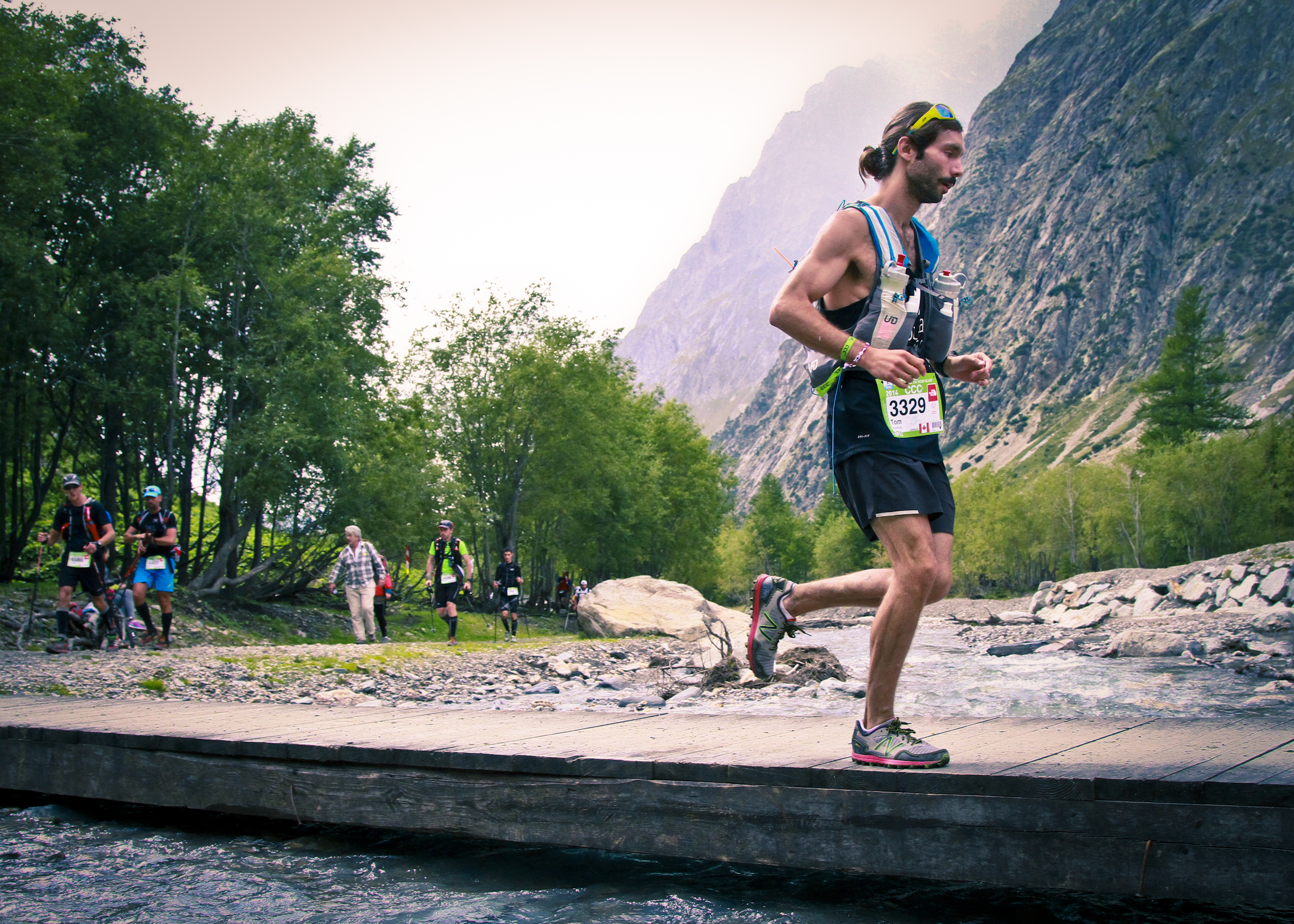
In August of 2014, I ran and completed CCC, a 101km ultramarathon through the mountains of Italy, Switzerland and France. This race is part of the week-long Ultra Trail du Mont-Blanc, one of the most popular and prestigious long distance trail-running series in the world. This is my report.
Kicking into high gear after exiting Arnuva at km27, about to start the climb up to 2500m Grand Col Ferret.
I come rushing in from the dripping rain, grab a bowl of chicken soup and slump onto a wooden bench. I’m cold and wet, tired as shit, and mud is smeared all over the place. It’s been raining for several hours and the trails have turned into little brown creeks burbling down the hillsides. Cows graze silently sentinel to hundreds of headlamped coureurs traversing the ridges surrounding Chamonix, its warmth and comfort radiating upwards from the valley below. I really don’t feel like going back out there, but I’m so close to being done.
“One more climb, eight hundred metres. Then 10K down into town. How hard could it be?”
What possessed me to run 100km around this stupid mountain?
Race day started August 29, 2014 at 7:30am with a flurry of organized transport: first I took a city bus from Taconnaz — a neighbourhood on the outskirts of Chamonix where I was staying — downtown, then a coach to Courmayeur, Italy. The ride was short and mostly spent inside a tunnel beneath the Mont Blanc massive, this being the primary thoroughfare between these two mountain villages. The bus emerged into the Italian dawn and switchbacked down the hill as I peered around wide-eyed and unthinking, just taking in the enormity of my experience. “You’re here, at CCC, the big race,” I said to myself. “You should be so proud. All that preparation. All that training…”
“Holy fuck. 100 kilometres? 6000 metres of climbing? What the hell did I get myself into?”
I was genuinely concerned with this most fundamental realization as the bus stopped and I got up like everyone else and marched toward the starting area. The energy was intense — more like some kind of dance music festival than the start of a footrace — with booming loudspeakers; announcers and spectators chattering in various languages; news helicopters high in the air and little quadcopters hovering over our heads. The starting line was supposed to be organized by bib number, but there were so many runners and so much activity, I picked a spot halfway in the pack and snuck in. Since my confidence had apparently evaporated during the busride from Chamonix to Courmayeur, my strategy for the present was to run conservatively, run my own race, and not worry about my position or that of anyone around me.
Once the UTMB themesong, Vangelis’ Conquest of Paradise, started to play, a warm feeling welled up inside. I lowered my shades and tried to hide the little tears in my eyes. The stoke was so high it was electric.
Three, two, one…
“Yeah, I visited Courmayeur once. Took a bus there, spent twenty minutes loitering then ran off into the hills…”
I trotted through the streets of Courmayeur amid an international array of fifteen-hundred ultramarathoners, my aim being generally not to run too fast. It was inspiring to see so many locals out lining the streets, shouting, “Venga, venga! Bravo!”, clanging cattlebells of all sizes and even old bakery ladies slapping breadknives against their cutting boards. We didn’t spend long in town, however, before departing cozy Courmayeur and beginning the first climb of the day up to Tete de la Tronche.
“Procession” is the word which characterized the first climb of the day up Tete de la Tronche.
Here I was rather rudely awakened as over a thousand runners attempted to bottleneck onto the first bits of singletrack trail that this race utilizes in great quantity. “Procession” is the word which characterized the first part of this race as we slowly plodded or sometimes stood at a standstill in a long queue switchbacking up the hill. Though confused, I was equally content to trickle up the first climb of the day at this snail’s pace while, looking back, what took us over two hours should have taken less than half that time and only resulted in me being out there longer, at nighttime, when I was tired and when it was raining. Lesson learned.
Top of Tete de la Tronche: this is what UTMB was all about.
Once we reached the top of Tete de la Tronche, the procession opened up and we skirted across wide open ridges with the Italian Aosta Valley falling away to our lefts and a storm-shrouded Mont Blanc brooding to our rights. This is what UTMB was all about. This is why I wanted to run this race in the first place. This is why I came here, to run some motherfuckin’ singletrack on some motherfuckin’ ridge in the sky with some bigass motherfuckin’ mountains in the background.
Hells yeah.
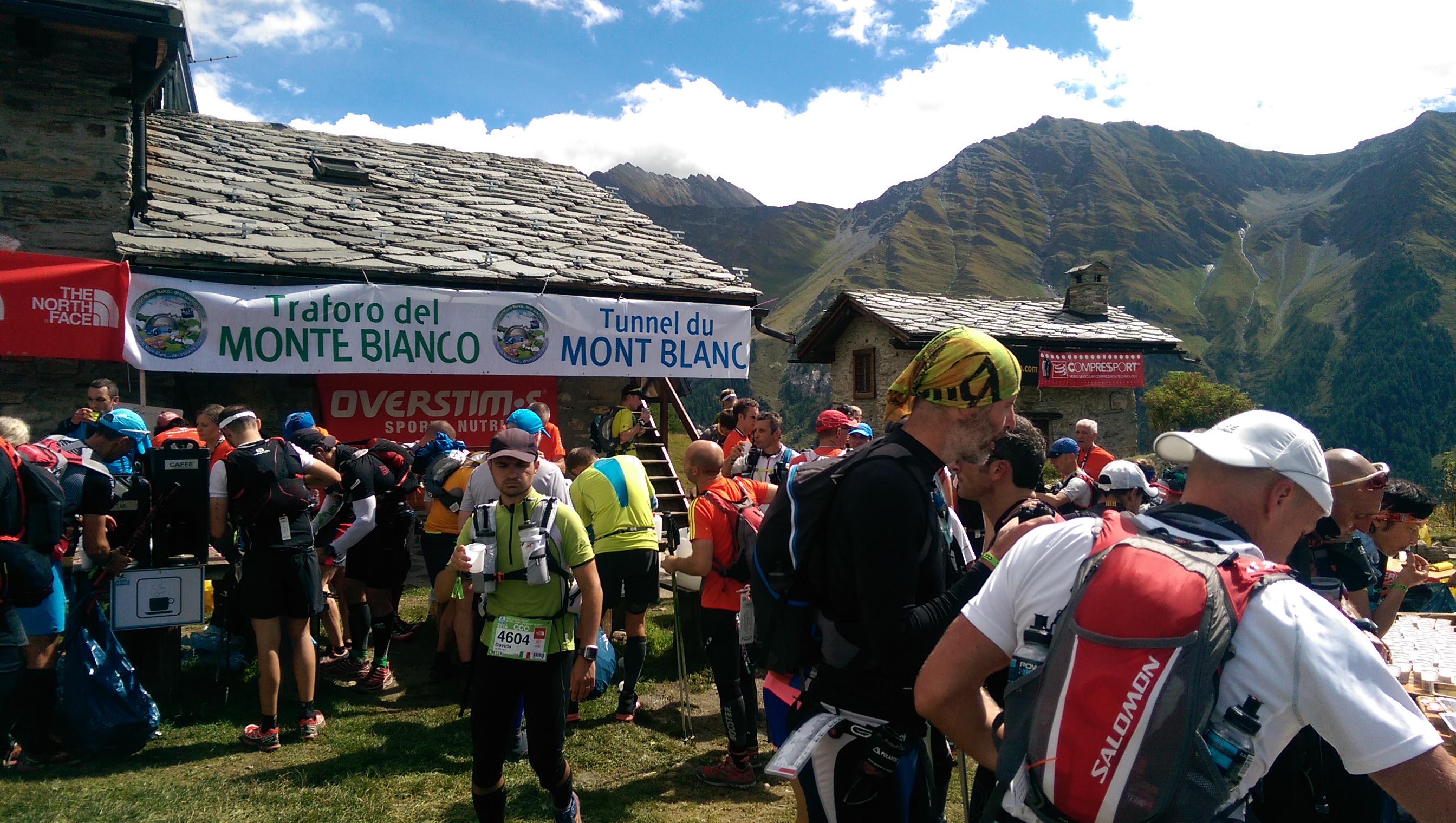
“All You Can Eat buffet” — I mean, “Aid Station”.
We descended into Refuge Bertone where I was pleased to discover that what’s called an “aid station” in Europe is actually what we refer to as an “all-you-can-eat buffet” in North America. Cheese, crackers, fresh bread, cookies, nutrition bars, dried meat, soup, chocolate, coffee, tea and more were all for the taking by the hungry runner. Thus, I generally spent way too long in these absurdly comfortable aid stations. Second lesson learned: don’t get distracted by the munchies, Tom!
Peace, Italy! Onwards to Switzerland.
After Bertone, we began the long, undulating traverse along the Italian flank of Mont Blanc east towards 2500m Grand Col Ferret, Italy’s border with Switzerland. Without any sustained climbs, it was pleasant to cruise along and enjoy the improving scenery and weather. There were lots of enthusiastic spectators throughout every part of this fairly remote course, but as I descended toward Arnuva I passed one who stood out. A little girl, perhaps seven or eight years old, with blond ringlets cheered, “Allez! Allez, Tom!” and nonchalantly gave me a high-five as I passed. This moment infused me with emotion — for little kids getting stoked about mountain, even endurance, sports is inspiring — and I continued to milk it for motivation throughout the rest of the race.
Marching towards Arnuva.Wow, horrible scenery!
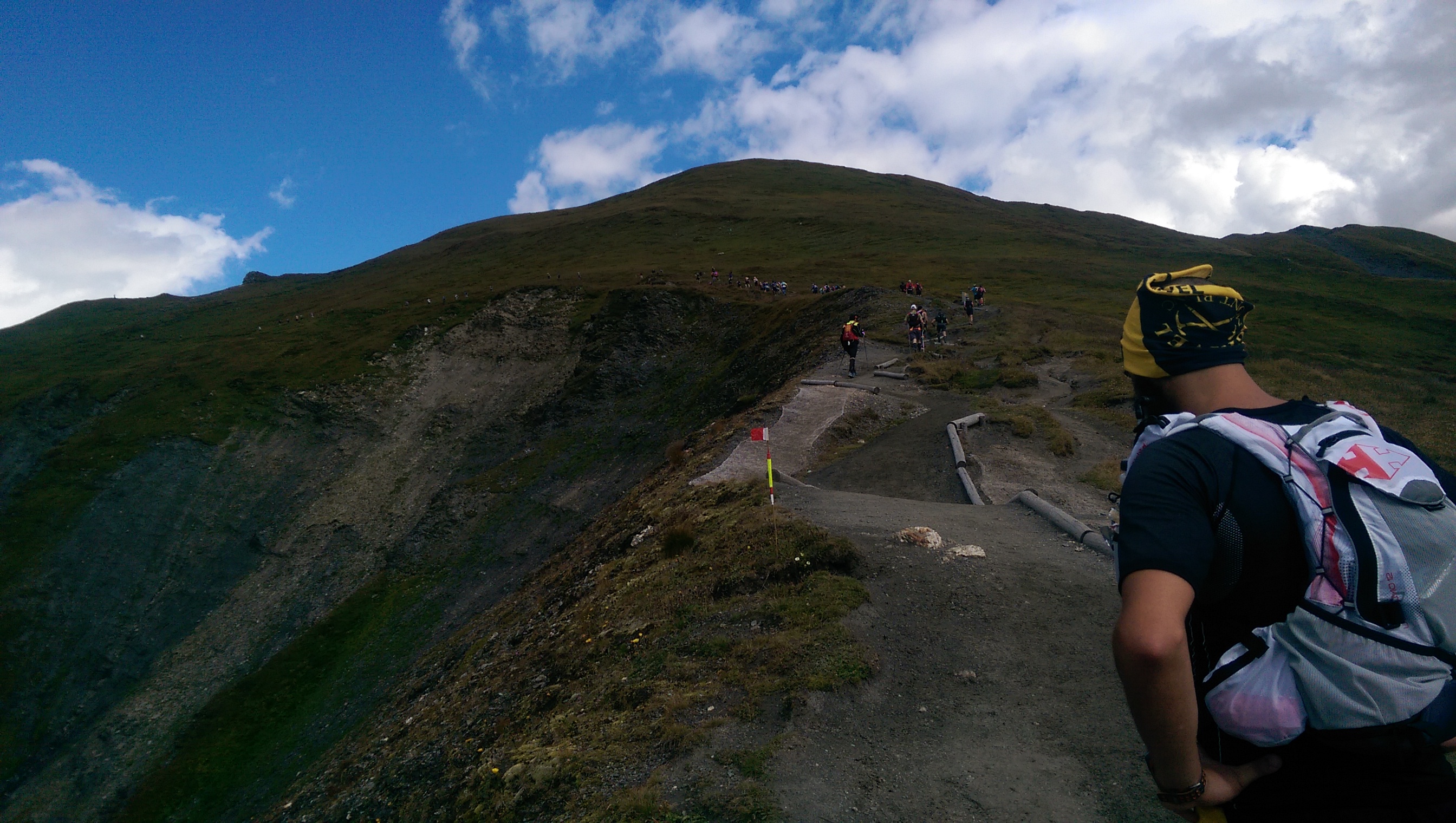
Leaving Arnuva, we began the long slog up to 2500m Grand Col Ferret, one of the highest points in the race. I sprinted along the river flats and soon encountered people struggling to ascend the (only) second climb of the day. I trotted up the moderate grade at a pace I might employ on Tunnel or Sulphur Mountains in Banff — hills I run in entirety — then put hands to knees and powerhiked, passing a couple hundred resentful runners along the way. The masochistic quantities of vert I’d put into my body over the summer had prepared me, and standing on top of the high pass overlooking Italian Val d’Aoste on one side and Swiss Valais on the other, I felt fresh and unfazed.
Looking back towards Courmayeur and the direction we came from.Slogging up Grand Col Ferret.Top of Grand Col Ferret.
Surprised as I was to see people struggling up the col, I was equally surprised to see others hesitant to move quickly down its extremely runnable backside toward La Fouly. It was here that I experienced my only bout of stomach upset, bolting down a hard-packed gravel trail with me and everything inside me (including a lot of gel) being repeatedly hammered by freefall and then impact. I clasped my fingers and pleaded; looked skywards to the ultrarunning gods and prayed for them to save me. Then as fast as it came, my nausea retreated and it was back to snapping pics and putting one foot in front of the other, in that order.
Swiss Valais, en route to La Fouly.
Leaving Champex, it began to get dark. The temperature was warm but it was drizzling so I made the (perhaps absurd) decision to remove my damp singlet and wear my Gore-Tex shell with no shirt underneath. I did this to preserve my still dry midlayer shirt which I would surely need later when it became colder and wetter. As can be imagined, soon I was damp on the outside with rain and literally dripping with sweat inside my shell, so the waterproof quality of my ~$500 jacket was more or less nullified. Since the race, I’ve reflected on this decision which made me very uncomfortable for the next few hours but ensured I wouldn’t be hypothermic and unable to finish later on.
The sun set as we started the march up to Bovine. No one who has not run a UTMB race — or at least run around these hills after dark — can understand the horror inherent in greeting enormous, munching cow faces grotesquely illuminated by one’s headlamp. The mood was spooky, like some sort of zombie film, with thick mist hanging over the damp soil which hundreds of trail-running sneakers tilled with squishy fart sounds each footstep.
The trail was profoundly wet and rivulets of muddy water followed the path of least resistance wherever it could be found. My descent into Trient thus took on a form of locomotion closer to downhill skiing, or sliding into home-base, than running by any means.
My shoes hit cobblestone and I jogged toward the aid station when I heard someone shout my name. On this side of the world, there was only one person who knew me or my name and I was stoked to see him. Louis Marino, in whose flat I was staying in Chamonix, had been leading a multiday tour around Mont Blanc, and after his clients had wined and dined he waited around in the rain to catch me without knowing for sure that he would.
I couldn’t tell you where this picture was taken, but I still look clean and happy so it couldn’t have been very far into the race.
I stopped and talked with Louis and some drunken farmer (for these aid-stations were lively social events for locals who lived in the semi-remote pastures) while simultaneously toweling dry the inside of my jacket and donning the midlayer shirt I’d preserved until now.
Louis asked how I was feeling and I had to admit I was feeling fine. “Fine?” he said with some skepticism. Not even a little tweak? Strain? Sore spot? He surely wondered which form of hard drug I’d been abusing to get me through this race. Meth? Maybe crack. It was uncanny, and I recognized this, but I felt okay. I was cold, wet, mentally tired and, sure, physically fatigued but for all intents and purposes I felt fine.
“DO WE HAVE A TOM AMARAL IN THE CROWD?” I then heard over the loudspeakers.
For the second time in twenty minutes, my head perked up like a deer in highbeams. Apparently, two people in Europe knew my name. I lifted my hand sheepishly.
“HEY TOM, THIS ONE IS FOR YOU!” said the announcer, then this came on:
The aid tent at Vallorcine was total and utter carnage, with runners sprawled everywhere… Some were slumped head down on the tables surrounded by food from the checkpoint, clearly having lost the battle against tiredness. — Hong Kong Trail Runner
Around 1:30am, I ripped down into Vallorcine like some sort of crazed mountain-running automaton, grabbed a bowl of chicken soup and slumped down onto a wooden bench. I crushed one bowl of soup, then another, shivering, still dressed in shorts. There was only a comparatively small amount left in the race. From here, I had an 850m climb to the top of Tete aux Vents on the Aiguilles Rouges then an eleven kilometre descent into downtown Chamonix. Eight-hundred metres is nothing, I reasoned. I can climb eight-hundred metres in my sleep. In the peak of summer, if I only climb eight hundred metres in a day, I come home all depressed and bummed because I only climbed eight-hundred metres that day. But this climb was the CLIMB FROM HELL.
The stumble up Tete aux Vents/Flegere was hideous. There was a lot of cursing; that last hill is sadistic and makes anything else I’ve ever done in a race pale in comparison of difficulty. – Anton Krupicka
By this point, it was three in the morning. Rain had been falling for over six hours. I’d been awake for nearly twenty-four and running for eighteen. This last climb of CCC — and UTMB — was some of the steepest and rockiest slogging (that isn’t technically “scrambling”) I’ve ever encountered, a borderline third-class staircase of jagged stone steps meandering steeply up the mountain and into the dark.
Once we topped out and passed the Tete aux Vents checkpoint (two guys wandering around with a barcode scanner in the dark), I incorrectly assumed (wishfully thought?) that we were on our way back to Chamonix. In reality, we still had yet to hit the final aid-station, Flegere. The long, slippery traverse across the Aiguilles Rouges was taking so much longer than expected that I’d lost track of where I was or how close I was to being done. I simply kept my eyes locked on the trail, knees high and feet moving. The tediousness of watching the ground was tempered by sublimity in the sky, however: an temperature inversion caused the cloud cover to descend into the valley, revealing the lofty, white summit of Mont Blanc standing guard beneath a canopy of stars.
Finally we hit Flegere and I sat there silently, nursing a final bowl of soup. “Okay, that climb was a little harder than expected,” I said. “But now it’s only 10K down into town. How hard can it be?”
Those cruel and sadistic UTMB course designers, they knew what they were doing when they picked this route. They knew the CCC runners would be suffering: cold, wet, tired and hungry, lacking coordination and wanting desperately to finish. UTMB runners would be the same, only worse. They might have selected some soft, cruisy, runnable trail for the last ten kilometres of this race, something like any number of other trails utilized during UTMB. But no, they singularly opted for the most frustratingly rooty, rocky, almost-runnable trail possible.
Back home in Banff, my girlfriend and others followed along online: “Ten kilometres to go, how hard can it be?” they wondered. As painful as the last ten kilometres were for me stumbling down from the top of Flegere, they were surely as painful for my friends staring at my progress halted on their computer screens. When things began to take longer than expected, they speculated that I was injured or walking, which is precisely what I was doing though I wanted nothing more than to be bounding along gracefully like some agile Chamois.
After what felt like an eternity of downhill hiking (something I hate on a good day), the trail mellowed, grew a little wider and allowed me to stretch out my legs and actually run. When I finally spotted the texture of drab concrete lit by the dull, orange glow of a streetlamp, I thought it was a mirage. “Finally!” I gasped cathartically as the rubber on my sneakers left the dirt and met the road. Running on pavement had never felt so good before.
Once off the trail, I had only a few kilometres left to run through the familiar streets of downtown Chamonix. I jogged along, nearing the centre of town. It was six in the morning and everything was quiet. I’d been on the move for twenty-one hours and awake for over a full day. The glow of a new morning was beginning to appear, I was somewhat disoriented and wasn’t really sure what day it was. But here I was at the finale of an event I’d variably lusted after and dreaded; anticipated and trained for; cursed and reviled – the whole spectrum of every emotion – and now it was all over.
Most important to me was the feeling of many years of hard work being examined and me passing the test. I’ve always considered the mountains an arena for challenging oneself, but here I’d travelled to a strange place and set my blend of Canadian Rockies mountain-running against an altogether different grindstone. Summers spent wandering aimlessly in the Yukon, then scrambling in the Rockies in a perpetually lighter and faster manner, had developed into a mature state. The feedback loop I had nurtured between me and my home mountains — the lessons I`d learnt and the machine that had been chiseled out of continual contact with them — was proven to be something that could be exported and successfully applied to epic mountain ranges elsewhere in the world.
I crossed the finish line looking like the embodiment of good running form, then hobbled over to collect my finisher vest – a teal Polartec fleece vest I’ll probably never wear, but of which I’m goddamn proud. I looked back wistfully at the finishing area and iconic UTMB arch like a final glance to a lover one will never see again, then shuffled off alone. Sidewalks normally inundated were vacant and void, save for me in my filthy trail-running garb. I couldn’t wait to brew up some Lavazza, hop in the shower and hit some of that hash I got off that English kid, but I was going to have to find a way home first.
I guess I could run home; it’s only ten kilometres. How hard could it be?
Gear: The following is a list of gear that I wore or carried during the race. Ultra Trail du Mont Blanc races, including CCC, require several items of mandatory equipment be carried at all times.
All of the crap I had to carry around for 100km…
Arcteryx wool cap
A Buff
Julbo sunglasses
Mountain Stride Fitness singlet
Arcteryx Phase base upper (utilized as a midlayer shirt)
BORING! A 57km backcountry trail run from Mt. Assiniboine to Sunshine Meadows through some of the finest subalpine scenery the Rockies has to offer. A cold, cloudless morning at Mt. Shark trailhead turned warm and sunny as we cruised along buttery singletrack, climbed a couple gnarly passes, ran out of water when we needed it most and narrowly dodged thunderstorms, experiencing the full spectacle of mountain weather without bearing the brunt of it. In the course of our trip, we crossed the BC-Alberta border six times, courted a few aches and pains, incessantly made fun of each other, and crushed nearly 60km of Continental Divide eye-candy in one sitting. Like I said, pretty boring…
What’s generally treated as a two- or three-day backpacking excursion was one long but overly scenic backcountry jog for us. I really had no idea we were in for such a slog up to Citadel Pass more than halfway through the run, but perhaps it’s better we didn’t know… I’m sure Pat and Jordan loved it 🙂
Our first views of Assiniboine.
3618m Mount Assiniboine and Magog Lake seen from near Assiniboine Lodge.
Departing the Assiniboine area and heading north toward Og Lake.
Awesome rock outcroppings, manicured-looking turf and smooth singletrack trail…
Heading toward a constriction in the meadow along Og Creek.
Hey, they call this area “Valley of Rocks”… I wonder why that’s the case.
Jordan and Patrick descending towards Og Lake.
Descending rocky trail to probably reascend again somewhere else
Getting faded, with Assiniboine and our previous 40km in the picture behind us.
At the top of Citadel Pass, marching toward Quartz Hill in centre, with glaciated Mount Ball on right.
Rock outcropping on the side of Citadel Peak, seen as we crossed Citadel Pass from BC back into Alberta.
Jordan running towards Quartz Ridge, our final climb of the day.
Jogging through a lush meadow toward our last climb up Quartz Ridge on right.
Circling Howard Douglas lake on our way up Quartz Ridge.
In awe, or “aww shit, we still have really far to run”?
Jogging the white ribbon which leads back to Sunshine Meadows from the top of Quartz Ridge. Spectacular trail running!
What began as a bluebird day became quite rainy and stormy, everywhere other than directly above us
“Did I say fading, I meant 5K to go!” Patrick says as he sprints toward a thunderhead which looks like a volcano erupting overtop of Bourgeau.
It was awesome to experience the spectrum of mountain weather all around us, but without actually getting soaked by rain or hit by lightning. We certainly got drizzled on, blasted by wind, and cautiously marched toward the top of Citadel Pass with an extremely active thunderstorm hanging over Fatigue Mountain to the north of us, but for the most part the weather made for a more complete experience of this landscape than a bluebird day would have offered.
If anything could prepare my eyes for the scenery I’ll see running around Mont Blanc in The Ultra-Trail du Mont-Blanc CCC next month, it might be this: A 60km out-and-back tour of Mount Robson to peep the Rockies’ tallest peak firsthand.
What was intended to be an “analogue run” two weeks prior to Trailstoke 60K Ultra in Revelstoke turned into a glorious day of warm sun and cool breeze; more roaring waterfalls than I can count on one hand; neon blue tarns with creaking glaciers flowing into them; buttery subalpine singletrack; chossy, exposed ledge running and sprinting up lateral moraines like some dude in a North Face ad; a little hands-on-knees grunting; about three litres of unfiltered mountain water and a near-miss with momma bear and cub. Just another day running around in the Rockies half-clothed 🙂
Splits:
0:31 Kinney Lake
2:45 Berg Lake
5:01 Snowbird Pass
7:57 Berg Lake
9:38 Kinney Lake
10:23 Berg Lake Trailhead
Trail running opens the doors to seeing more in less amount of time; what is generally treated as a two- or three-day backpacking trip then becomes a daytrip for the long-distance trail runner.
Buttery-smooth packed-stone trail dropping down from Land Of A Million Waterfalls (my own name for it) to the river flats near Berg Lake.
Berg Lake and the Rockies’ tallest mountain, Mount Robson (3954m), towering two vertical kilometres over the tarn.
Standing above Snowbird Pass (2719m) on the BC-Alberta border, looking down on the NE face of Mount Robson and the valley I just ascended. I am now 30km from my vehicle and feeling fairly fresh, but trying to avoid thinking about the next 30km I need to travel to get home…
View of Mount Robson and Whitehorn from my little perch above Snowbird Pass.
Looking down to the Coleman Glacier on the east side of Snowbird Pass. The pass and ridge I ascended to get here can be vaguely seen on left.
Looking down to Mount Robson’s huge north glacier during my descent from Snowbird Pass.
Back to the soft, cruisy trails of the Berg Lake area which my legs appreciated for the last 20km back to the car. Awesome trails and awesome scenery!
On the summit ridge of Mt. Lady Macdonald, 9 hours after starting the three-peak, 38km, 3500m vertical Canmore Triple Crown.
My second go at this masochistic little scrambling endeavour first devised by two buddies of mine in 2012 and reconfigured by myself into a 100% bipedal effort around this time last year. The Triple Crown is a one-day ascent of Mount Lady Macdonald, the east end of Mount Rundle (EEOR) and Ha Ling Peak, a grand tour of the city of Canmore, Alberta totalling thirty-eight horizontal kilometres and over 3500 metres (puke!) of accumulated vertical gain. Assuming I was stronger this year than last, I had definite intentions to beat my old time (12 hours), but both trips certainly involved their fair share of lollygagging, selfie-taking, and sitting on my ass eating sandwiches whilst cursing the mountains.
I crushed my old time, sweltering in inferno-esque temperatures (to me, anyway), chugging back melted snow with my running pack fully prepared for winter-mode if necessary. It definitely wasn’t necessary. I hope to return to this project some day with a lighter pack and a little less time devoted to taking pictures of myself to put up a truly speedy FKT. Until then, I’ma hit up this foam roller and drink some water 🙂
Splits: (7:45am start from Rocky Mountain Bagel Co., downtown Canmore)
1h03m – EEOR trailhead (TH) | 6.4km | 372m ↑ | 6.4km total
1h12m – EEOR summit | 2.3km | 884m ↑ | 8.8km
0h51m – EEOR TH | 2.4km | 872m ↓ | 11.2km
1h03m – Ha Ling summit | 2.9km | 801m ↑ | 14.2km
0h43m – Ha Ling TH | 2.9km | 808m ↓ | 17.2km
1h54m – Lady Mac TH | 11.1km | 469m ↓ | 28.3km
2h13m – Lady Mac summit ridge | 3.9km ↑ | 1182m | 32.7km
1h02m – Lady Mac TH | 3.3km | 1151m ↓ | 35.5km
0h17m – Bus stop | 2.5km | 118m ↓ | 38.0 km
This year I don’t need to carry the front page of the National Post with me to prove I bagged all these mountains; now I have a fancy GPS watch which tells me all sorts of nerdy details about my trips
View out my window at 5:45am on the morning of my Triple Crown trip.
Steep Ha Ling Peak, mountain #2 of the day, seen across Whiteman’s Gap during my ascent of the East End of Rundle.
Standing on top of the east end of Mount Rundle, 2590m, two hours and fourteen minutes after departing downtown Canmore.
View of one of Rundle’s subpeaks, arguably a cooler feature of Rundle than it’s actual summits. Evidence of spring avalanches was everywhere although the scramble routes on each of the Triple Crown peaks were pleasantly dry.
Eating a ProBar in the rock shelter (which offers mininal shelter) on top of Ha Ling Peak, 2408m, four hours and nine minutes after leaving downtown Canmore. Mighty Mount Temple is in the background at far left looking closer than it actually is.
A gorgeous day in Canmore, seen from the top of Ha Ling Peak. One thing I love about the Triple Crown and long-distance mountain running in general is the different types of locomotion required over the course of the day. After ascending two rather steep peaks in a fashion similar to climbing stairs by skipping every other step — for a vertical kilometre and a half — one is then required to actually run eleven kilometres across the valley and slog up the biggest peak of them all 😐 Who came up with this stupid idea, anyway?
Looking from top of summit #2, across Whiteman’s Gap to the east end of Mount Rundle, summit #1 of the day.
Top of Mount Lady MacDonald, 2605m, eight hours and fifty-seven minutes after first leaving downtown Canmore at 8am. It is now nearly 5pm and fairly windy. Whereas I hit my low point ascending Ha Ling Peak last year (peak #2), this year I felt strong until I got to Lady Mac and then staggered up the mountain, stopping every few minutes, lightheaded, to heave back oxygen like I don’t do this on a regular basis. The glory of physically challenging endeavours is when that quality that one needs to do what one’s trying to do — drive, will, “mojo”, physical energy, period — is utterly drained, yet one pushes on regardless. This realization has been both a gift and curse, as I now realize that no matter how weak and shitty I feel, I probably, actually, have the ability to push on indefinitely. This makes copping out a little harder to justify.
The knife-edge ridge which leads to the true high-point of Mount Lady Macdonald… I like this ridge when it’s dry and when winds aren’t so gale-force. I’m only a hundred and fifteen pounds and this Arc’teryx shell is like a wingsuit on me
View looking back down Mount Lady Macdonald’s SE ridge which, at the moment I take this photograph, I despise very, very much. Most of the ascent up Lady Mac consists of really good trail until you reach the “bench”, site of the old teahouse (middle of picture). The final push to the summit ridge is loose and exceedingly tedious: one of my least favourite sections of mountain I’ve personally experienced. Smart of me to least the worst for last?
My trusty New Balance MT110W’s which got me through this silly trek. I think they liked it better in the soft, clean snow of winter; not so keen on this scree stuff…
I often do epic things in the mountains right before going home to Ontario to visit so I am somehow imbued with epicness and the spirit of adventure in a place I associate with an almost suffocating sense of banality. I don’t think this practice really counts for much, except perhaps to stroke my ego, but it’s not like I boast about my adventures and once home my focus became firmly centred on visiting friends, spending time with my family and revisiting old hiking haunts in my newfound trail-running style. I also ran a rather flat 10km trail race at Terra Cotta conservation area which, by some stretch of the imagination, serves as a qualifier for a spot in the elite division at the Canadian Mountain Running Championships, a 12km/1200m vertical sprint at Kicking Horse Ski Resort, Golden, British Columbia three weeks from now which I’ll also be attending.
The place that helped me “train” for hiking in the Yukon and the Rockies (not really), Forks of the Credit Provincial Park, Caledon, ON.
Though the Terra Cotta course was a modest one, it was a good, early test of a new dimension of running I want to explore: speed. In the past I’ve always focused on distance, building the overall length of my long runs week after week, trotting along through the backcountry for thirty, forty, fifty kilometres at a pace intended to keep me from sweating too much and prematurely burning too many calories. Now I wanna do the same thing, faster. Misunderstanding how the race’s timing worked, I snuck into the back of the first wave seconds before the starting buzzer and shot off in a high-velocity tiptoe through the winding roots which covered the trails of this course. I finished in a respectable (for me, anyway) 19th place out of 260 runners. Not fast enough to qualify for the mountain running team, but I have different racing plans on my agenda this summer, anyway. Peep the Movescount data for this race here.
One hell of an approach: 30km from Banff to Canmore to climb Ha Ling in its worst snow conditions all year. 45km total, 1300m vert.
My calves feel like they’ve been used for boxing practice. Getting out for long runs rather inconsistently, yesterday’s thirty kilometre run to Canmore and ascent of Ha Ling Peak in the deepest and slushiest snow conditions I’ve ever encountered it in means I’m a little sorer than usual today. To reach Canmore I jogged along the Rocky Mountain Legacy Trail, which is much flatter, paved and runnable than what I’m used to running on, so I wasn’t really sure if the benign-ness of my chosen route would destroy me over twenty-five kilometres.
After a big dump — which we just received a weekend of — I’m used to powder piling up on Ha Ling at treeline, resulting in, say, a one-hundred metre stretch of waist deep sugary snow to plow through, with the rest of the peak wind-scoured and barren. Yesterday, however, I found the whole alpine zone of the peak caked with knee-deep isothermal snow from treeline to summit, with a crust that would barely hold your weight with one step and would break through on the next. Of course, what did I really expect at 4pm in the afternoon on a sunny day after, oh, our biggest single snowfall of 2013-14? I rank that as my most arduous ascent of Ha Ling, ever.
Descending Ha Ling wasn’t too difficult; I gained so much momentum on the slushy, muddy lower part of the mountain that I almost ran over Adam Campbell, 5Peaks Race Series organizer, Arc’teryx-sponsored athlete and one of Canada’s strongest male ultramarathoners. We shared gripes about the post-holing nightmare that was the top of Ha Ling and chatted about trail-running, races and the revered New Balance MT110 over a few kilometres through the boulders of Grassi Lakes before my descent into town. A highlight of my day. Peep the Movescount Move for this trip.
In other news, looking forward to giving these guys a spin… La Sportiva Anakonda mountain running flats.
Never thought I’d ever actually summit these guys, let alone run all over town to do it, or bag multiple in one day…
In the spring of 2011, while traveling to the Yukon, I stopped and took a picture of Canmore’s mountains with my phone and sent it to my buddy Jay, saying, “Yeah, I think this is where we wanna be.” For months we’d discussed setting up shop in Canmore (because living in Banff seemed like a pipedream) and spending all our free time bagging every summit possible. I pictured myself like some old-school mountaineer with wool alpenstocks and a long ice axe toiling up these snowy mountainsides amid snow squalls and spindrift…
Although the steep rock faces seen in the top picture possess heaps of technical climbing routes, I never suspected the backs of these mountains had routes that could be walked (or run) up in a matter of hours. Three years later, Banff is my home and the Canmore mountains I’d once fantasized about climbing are now routine trips I do in the dead of winter, when my eyelids are freezing shut, or on days when I don’t really feel like hiking or running at all. The thought of actually standing on top of these peaks once seemed incredibly out of reach, let alone doing it in a style that is fast, light and aesthetic or linking together multiple peaks as per the Canmore Triple Crown, which I wish to repeat this season.
I’m grateful every day for this landscape, the passion it inspires and what it has molded me into.
Overlooking Banff’s Massive Range from Sulphur Mountain’s upper gondola terminal
Last week ushered in springlike temperatures in the Bow Valley, allowing me to strip off the leggings and try my hand at a couple different — variably slushy or icy — front range mountains.
The week began with my first time doing repeat runs up Sulphur Mountain (37km, ~2000m vertical) and my first outing wearing shorts this season! I’ve long seen Sulphur X2 as a fairly gnarly training day but both climbs were super easy and neither was any worse than the other. The stellar weather also let me to test out gear donated by Lululemon Athletica Banff for my go at Ultra Trail du Mont Blanc’s CCC this summer. Loving the superlight fabrics of the Metal Vent Tech and Surge Short, closest thing to running in a loincloth possible. And running in a loincloth is my life goal 😐
Looking over the top of Mount Lady Macdonald at a huge drainage notorious for flooding the town of Canmore last spring.
Thursday and Friday after my Sulphur repeat, I had some spare time to run/scramble — and I really just can’t help myself — so I hit up a couple of dry, windblown front range peaks. Thursday consisted of a 6km/800m jaunt up Heart Mountain bordering the prairies; Friday was a 10km/1250m ascent of Mount Lady Macdonald overlooking Canmore. Although free from deep snow, I found the trails on each incredibly icy due to recent melting during the day and freezing during the night. The clear, slick water-ice emphasized the dullness of my Microspikes and my need to seek out a file and sharpen those bad boys up. Goddamn shoulder seasons, first gnawing apart my YakTrax and now dulling my Microspikes…
All in all, last week I did four mountain runs in three days, back to back to back (to back). I ran about 53 kilometres and ascended over 4000 metres. Like I said, when conditions are prime, I just can’t help myself.
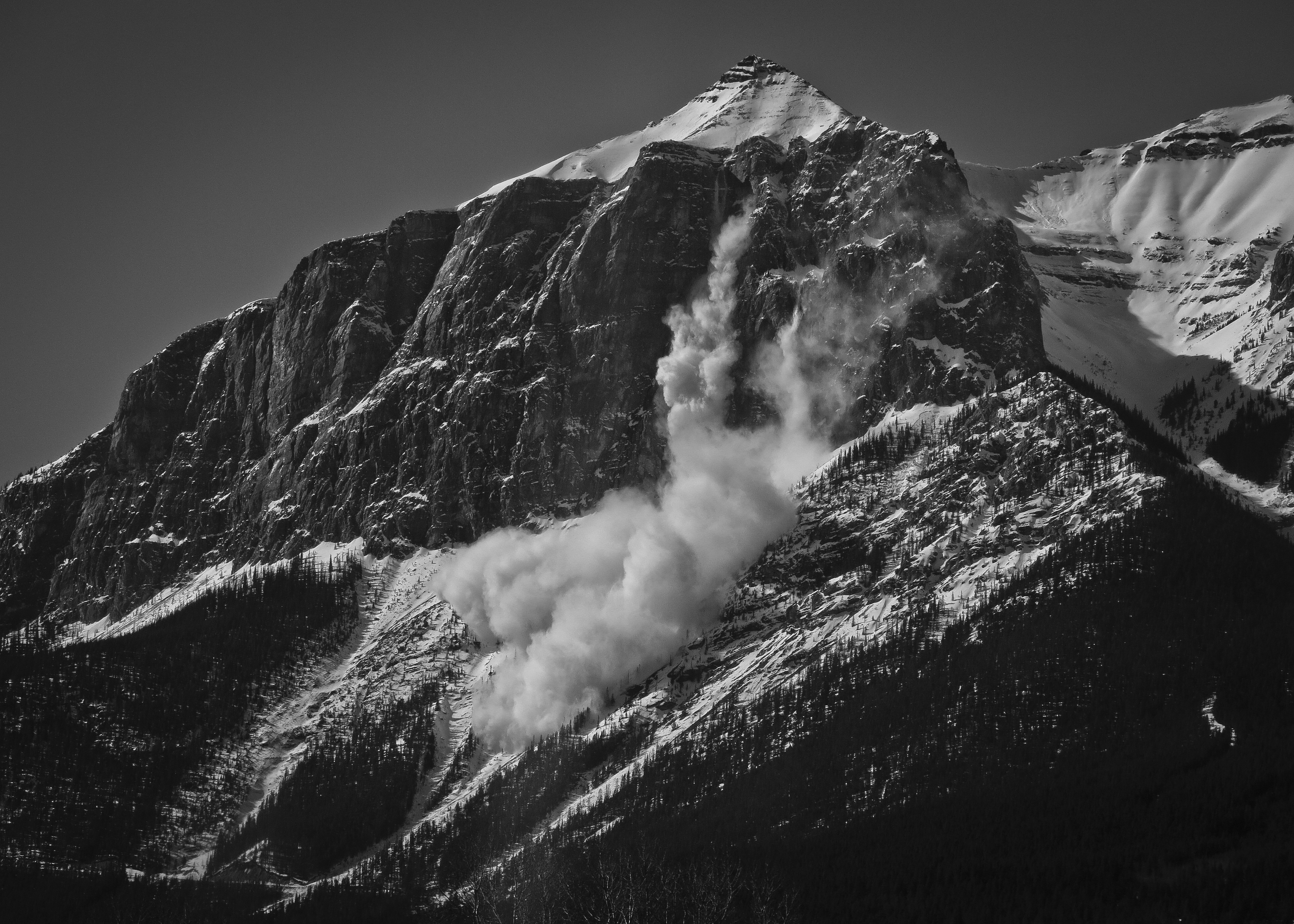
Ridge leading to the true summit of Lady Mac. Might give it a couple weeks before I give this a try…Witnessed avalanche control on the east end of Mount Rundle while paying for coffee in the drive-through.
 Last month I expressed mild disappointment over not achieving any long technical days in the mountains this summer. That is, little in the way of exposed ridgeline traverses, multipeak link ups or self-supported ultras in the backcountry. I mainly stuck to single summits, many I know well, going faster and lighter than ever before. In general though, one can either choose to be mediocre at new things (the definition of “novice”) or become really good at a given activity by doing it over and over again. It’s obvious now that the fruit of this summer wasn’t an extension of my activities into new domains, more a sharpening or deepening of what was already there.
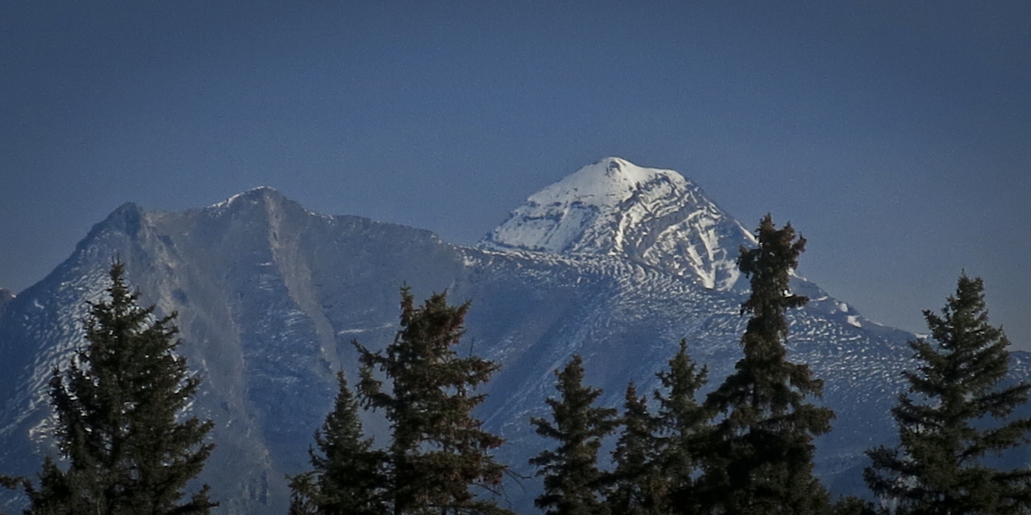 There’s nothing novel about bagging peaks on a bike, as Anton spent the summer rehabbing his shin by biking all over Colorado and Justin Simoni climbed the state’s 54 fourteeners in a row, pedaling in-between them. If mountain running is supposed to be about distilling mountaineering to its most minimal form, there ultimately seems something superfluous about driving a vehicle to the trailhead to do it.
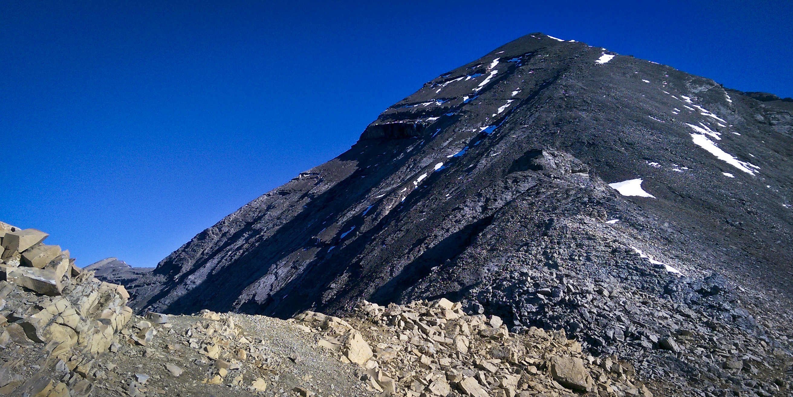 The homestretch to the summit is steep but untechnical and I slogged at a pace that was actually too hard for the altitude I was at. I repeatedly had to stop and catch my breath, reminding myself to hike slower or frustratingly redline myself every couple minutes.
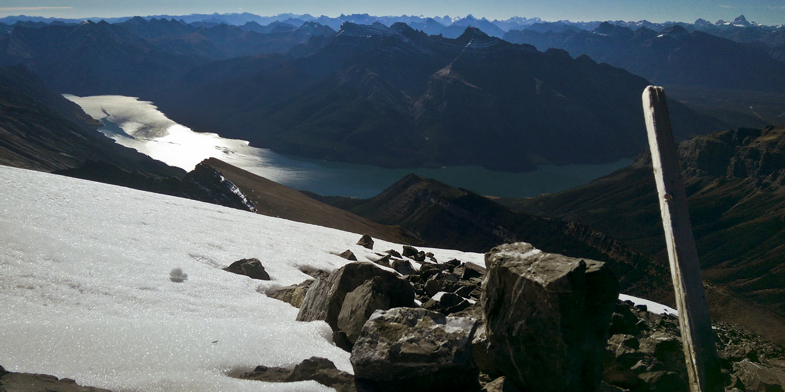 I hung around on top for nineteen minutes then headed down, plummeting 1600 metres in a fraction of the time it took to get up there. The only complication I encountered was descending too far down the avi gulch, past the faint Aylmer Pass trail which intersects it. When the eerie feeling of, “Something doesn’t feel right,” struck, I turned myself around and marched back up the drainage for a couple minutes until I located the path.
 The jog back to my bike was mundane but the lake was pretty and provided a cool breeze which made things quite comfortable. I remember our run in June being sweltering on the way out and on that occasion added injury to insult by bashing the soft underside of my foot on a rock. I reached my bike in 6h20m and flew mostly downhill back to Banff Avenue and Caribou Street in 6h49m, only nine minutes longer than our trailhead-to-trailhead time when we drove there in the spring.
 Splits: